Thailand and Cambodia have been locked in a border dispute for over a century, with tensions flaring up again in the summer of 2025. Peace efforts have seen limited success, and clashes continue.
A historical disagreement over colonial-era map lines often fuels nationalist sentiments. The two countries have shared what one historian describes as a “sibling rivalry” for decades, intensified by competing claims to the region’s rich cultural heritage, including ancient temples in contested areas.
The territorial dispute dates back more than a century to when France occupied Cambodia as part of French Indochina. Compared to today, the border between Thailand—then known as Siam—and Cambodia lay further south, meaning Cambodia was originally smaller.
In the early 20th century, a series of treaties between France and Siam pushed the frontier northward, expanding Cambodia’s territory. The 1904 treaty redefined parts of the border using a natural ridge-line as a key marker. A subsequent 1907 treaty brought a more significant shift, with Siam ceding the provinces of Battambang, Siem Reap, and Sisophon to French Indochina. These agreements helped establish much of the modern border and greatly expanded Cambodia’s territory to the north and northwest.
As a result, the border region is now dotted with ancient Khmer stone temples cherished by both sides. Moving the border north to follow the Dangrek escarpment—a ridge that also runs along a watershed dividing river systems—placed several important temples near the border. However, the treaties left their exact ownership open to interpretation, with both sides referencing different historical maps.
Three disputed temples lie along this escarpment: Prasat Ta Moan Thom (Ta Muen Thom in Khmer), Prasat Ta Khwai (Prasat Ta Krabey in Khmer), and Preah Vihear. While all three are contested, Preah Vihear has long been the focal point of the dispute. The 11th-century Hindu temple, known as Khao Phra Viharn in Thailand, has been controlled by both sides at different times. It predates Cambodia’s famous Angkor Wat by a century and sits on the edge of the escarpment.
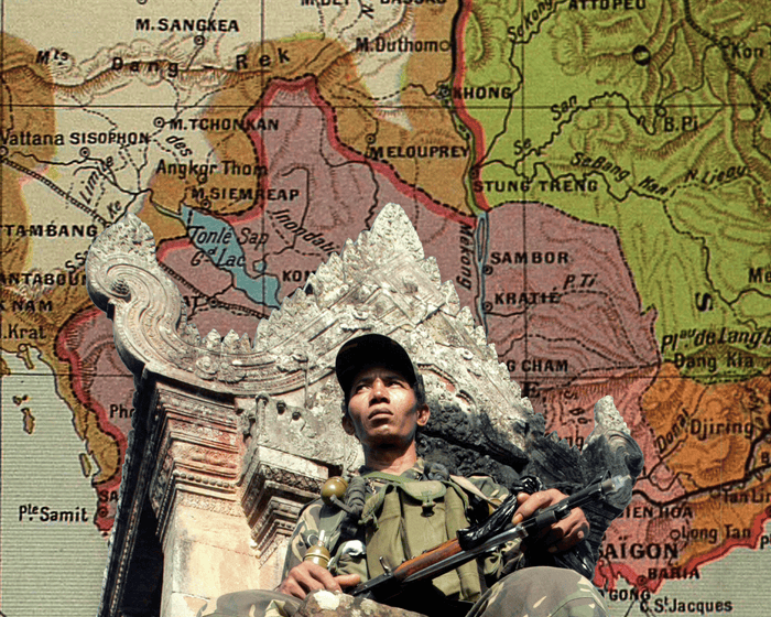
The modern dispute stems from a 1907 French-produced map, known as the Annex I map, which placed Preah Vihear on the Cambodian side. This contradicted the treaty’s instruction that the border follow the natural watershed of the Dangrek range. According to Shane Strate, a professor specializing in Southeast Asian history, the map’s boundary line largely followed the watershed but veered off course near Preah Vihear to enclose the temple within French territory before returning to the watershed line.
Siam did not formally object at the time, but the map’s deviation later became central to rival sovereignty claims. During World War II, Siam briefly occupied the temple before relinquishing control. Tensions resurfaced after Cambodia gained independence in 1953, leading to a case at the International Court of Justice (ICJ). In 1962, the ICJ ruled that the temple itself belonged to Cambodia, largely because Siam had not formally objected to the Annex I map in 1907. However, the ruling did not clarify ownership of the land surrounding the temple.The contested area around the temple has led to ongoing disputes. Thailand argues that the border should follow the watershed line mentioned in the original Franco-Siamese treaties, even though those agreements lacked detailed maps. This would allow Thailand to retain easy road access for tourists, who traditionally visited the temple from the Thai side.
Thailand contends that the watershed places Preah Vihear and nearby territory on its side, conflicting with the 1907 Annex I map that Cambodia uses to support its claim.
As both countries continue to rely on different historical documents and interpretations of this rugged border, Preah Vihear and surrounding temples are likely to remain points of tension.
Chris Baker, a historian in Thailand, noted that older maps and treaties are often used by neighboring governments with competing political and economic interests. “While these various maps exist and can be cited in disputes, I don’t believe this is fundamentally about the border,” said Baker. “The other factor is the longstanding sibling rivalry between the two countries, made especially intense because they are so alike.”
Frequently Asked Questions
Of course Here is a list of FAQs about the visual guide to the ancient maps and sacred temples central to the ThailandCambodia dispute structured from beginner to more advanced questions
Beginner Definition Questions
1 What is this dispute even about
Its a longstanding border conflict between Thailand and Cambodia over the area surrounding the ancient Hindu temple of Preah Vihear The core issue is where the exact border lies based on historical treaties and maps
2 Why is the Preah Vihear temple so important
Built over a thousand years ago its a stunning masterpiece of Khmer architecture a sacred religious site and a powerful symbol of national heritage and pride for both nations Its designation as a UNESCO World Heritage Site in 2008 intensified the dispute
3 What are these ancient maps everyone refers to
The key document is a map drawn in 1907 by French surveyors for an international border commission This map known as the Annex I map placed Preah Vihear temple on the Cambodian side Thailand has contested its accuracy and legal status for over a century
Intermediate Historical Context Questions
4 Didnt a court already rule on this What did it decide
Yes In 1962 the International Court of Justice ruled that the temple itself belonged to Cambodia based primarily on Thailands longterm acceptance of the 1907 map However the court did not rule on the surrounding 46 sq km area of land leaving that border ambiguous
5 If the court gave the temple to Cambodia why did fighting happen
While Cambodia owns the temple the most accessible entrance is from the Thai side Disagreements over control of this immediate vicinity troop movements and nationalist sentiments have led to sporadic but deadly military clashes most notably between 2008 and 2011
6 What was Thailands main argument against the 1907 map
Thailand argued that the map was not an official product of the border treaty commission and that it used a