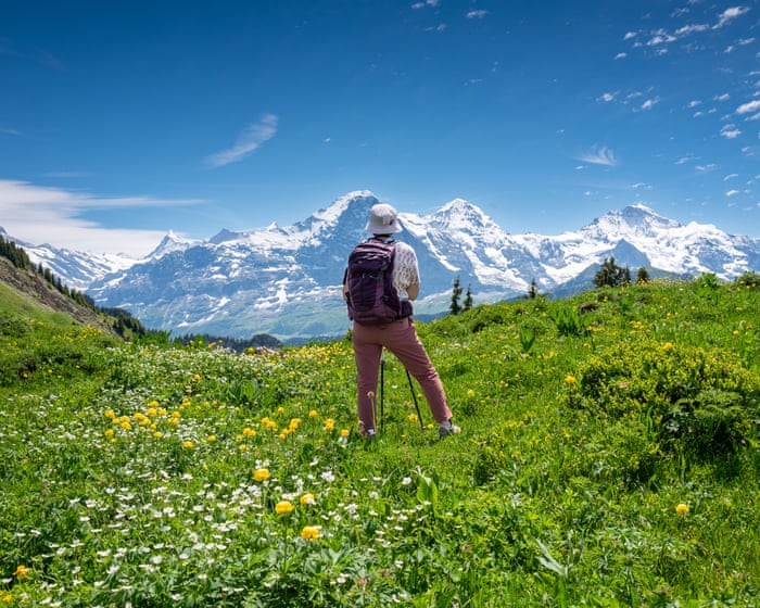
Switzerland’s Epic Jungfrau
Distance: up to 74 miles | Duration: 3–9 days
With tough competition, the Bernese Oberland is probably the Swiss Alps—maybe any Alps—at their finest. Here, the Jungfrau, Mönch, and Eiger stand together in a stunning lineup, lakes shine in incredible colors, waterfalls cascade through fairy-tale valleys, and charming villages cling to dizzying heights. And since it’s Switzerland, everything is linked by efficient PostBuses, gondolas, mountain railways, and, of course, hiking trails.
Summer is the best time for trekking—trails are free of snow, mountain huts are open, and the weather is most stable. There are plenty of route options. Cicerone’s new trekking guide, The Bernese Oberland, suggests a nine-stage, 74-mile tour of the Jungfrau region. It’s a beautiful, moderate-grade, hut-to-hut loop starting from the mountain village of Grindelwald.
If you’re short on time, you could spend a few days walking between the car-free villages of Mürren and Wengen, Kleine Scheidegg (where the Jungfraubahn railway climbs to 3,454 meters), Grindelwald, and Schynige Platte. The hike to this mountain ridge, with views up to snowy peaks and down to Lakes Thun and Brienz, is arguably Europe’s finest day walk.
How to do it: Accommodation is easy to find; you can book beds in Swiss Alpine Club huts in advance at sac-cas.ch. Macs Adventure offers an eight-day Grindelwald Trail trip from £1,510 per person.
—
The Alpe Adria, the Ultimate Pleasure Trail, Slovenia and Italy
Distance: up to 465 miles | Duration: 7–9+ days
If you have the whole summer, the Alpe Adria is a hiker’s dream: over 450 miles of easy walking, from the base of Grossglockner, Austria’s highest mountain, to the shores of the Adriatic.
If you don’t have time for the full route, try a one-week section in Slovenia’s Julian Alps. Even though the scenery is spectacular and it’s cheaper than, say, Switzerland or France, Slovenia’s mountains are still quieter than other regions in summer.
The stretch from the resort of Kranjska Gora to Cividale del Friuli, just over the border in Italy, includes the high peaks and passes of Triglav National Park, the emerald-green Soča River, mountain villages, and the Isonzo Front—where Italian and Austro-Hungarian forces clashed during World War I. You can still see old bunkers. It’s a moderate-to-challenging 80-mile, six-day hike, but well worth it. One of the best views is saved for last: the final climb over the Kolovrat mountain ridge offers a panorama that includes both Alpine peaks and the Adriatic Sea.
How to do it: See alpe-adria-trail.com. The Natural Adventure offers an eight-day self-guided trip from Kranjska Gora to Cividale del Friuli from £1,095 per person.
—
A Coastal Camino in Portugal and Spain
Distance: 170 miles | Duration: 2 weeks
If you’re set on a summer pilgrimage to Santiago de Compostela, make it this coastal route. The path from Porto to the tomb of Saint James is the third most popular Camino, offering plenty of fellow pilgrim company but fewer crowds than the busy Camino Francés. Plus, Atlantic breezes keep things a bit cooler, with lots of chances for a refreshing swim.
Starting from Porto, the trail follows the coast through fishing villages and wide stretches of golden sand up to Caminha, where a boat across the River Miño takes walkers into Spain. The trail continues hugging the coast to Vigo, the 100-kilometer mark to Santiago. Many pilgrims start here, as it’s the minimum distance needed to earn a completion certificate. Soon after, the Camino leaves the sea and finishes with an inland stretch, passing the hot springs of Caldas de Reis and the spicy peppers of Padrón.
How to do it: Municipal pilgrim hostels can’t be booked in advance (they’re first come, first served). Private hostels and hotels should be booked ahead in summer. Exodus offers a 15-day self-guided Portuguese Coastal trip from £1,839 per person.
—
Along the Lech, an Untamed Alpine RiverHere’s the rewritten version in fluent, natural English:
River in Austria and Germany
View image in fullscreen
The River Lech near Forchach, Austria, with the Lechtal Alps in the distance. Photograph: PK-Photos/Getty Images
Distance: 78 miles
Duration: 7–10 days
Walking by the water feels cooler. That’s what makes the Lechweg—a shaded, river-following trail—a great choice for a summer hike. This easy-to-moderate route was the first to be named a Leading Quality Trail by the European Hiking Federation, which means it has excellent facilities and clear signage.
The trail follows the River Lech from its source in the mountains (at 1,793m, so it’s only fully open from mid-June to early October) near Austria’s Formarinsee lake, all the way to the Lechfall waterfall in Füssen, in Germany’s Bavarian Alps. Soon after that, the river becomes calmer, dammed for hydroelectric power. But before Füssen, the Lech—one of Europe’s last wild rivers—runs free. Its turquoise waters twist across gravel plains, fed by Alpine streams, roar through gorges, and foam among pine forests and towering peaks.
Even though the landscape feels untouched, there are plenty of facilities. A string of mountain towns and villages offer comfortable places to stay, historic churches, and local artisans making everything from beer to cheese.
How to do it: Lechweg.com has details on trails and accommodation. Walkers’ Britain offers an eight-day, self-guided Lechtal trip from £990 per person.
—
The Beara Way: a quieter, wilder side of south-west Ireland
View image in fullscreen
Uragh Stone Circle on the Beara peninsula, Ireland. Photograph: Vibbily/Alamy
Distance: up to 128 miles
Duration: 3–10 days
South-west Ireland’s remote Beara peninsula is a great escape from summer heat elsewhere. Cooled by Atlantic breezes, it rarely gets too hot. And since it sits below the more famous Dingle and Iveragh peninsulas, Beara also avoids some of the crowds.
The Beara Way loops around this rugged finger of land, using tracks, bog roads, and narrow country lanes. It takes you through hills and valleys, past ancient stone circles, early Christian churches, 19th-century copper mines, and even a Tibetan Buddhist retreat. The full Beara Way, starting and ending in Glengarriff, takes about 10 days. Or you can spend a few days on some of the route’s 15 shorter circular walks. These include taking Ireland’s only cable car over the sea to Dursey Island for a nine-mile loop of this mostly empty isle, or catching the ferry from Castletownbere to circle Bere Island—an open-air museum with Martello tower forts, gun batteries, a lighthouse, and a harbour once fortified by Vikings.
How to do it: See bearatourism.com/beara-way. Hillwalk Tours offers several Beara Way options, including a 10-day full loop from £935 per person.
—
Sweden’s stunning coastal Kuststigen trail
View image in fullscreen
Ramsvikslandet, on Sweden’s Kuststigen trail. Photograph: Fredrik Schenholm
Distance: up to 234 miles
Duration: 2–5+ days
The Kuststigen isn’t one continuous hike along West Sweden’s Bohuslän coast. Instead, it’s made up of 44 well-marked stages (some connected, some not, and most easy to reach by ferry or bus). The trail shows off this stunning shoreline’s sapphire seas, pink granite outcrops, brightly painted fishing villages, and some of its 8,000 idyllic islands and rocky islets. That makes it easy to dip into for a few days of breezy summer hiking.
Sweden’s holiday season runs from July to mid-August, so it’s best to go in late August to early September (or next June), when the weather is still mild and the coast is less crowded.
Which sections to choose? Stage 22 (7 miles) loops around Ramsvikslandet, a striking peninsula nature reserve known as the Kingdom of Rocks. Combine it with stage 24, the linear Kungshamn–Tullboden route (10 miles), then take a ferry to complete stage 2.5. A 6-mile loop around Bohus-Malmön, passing ancient monuments and swimming lagoons. For an easy walk from the city, take the free ferry from Gothenburg’s Lilla Varholmen terminal to Hönö, and follow stages 1-3 (17 miles total). The trail opens up with flower-filled meadows, sandy beaches, swimming spots, and seabirds.
How to do it: Visit kuststigen.westswedentrails.se. For camping, see campingvastkust.se; for bus information, check vasttrafik.se.
Frequently Asked Questions
Here is a list of FAQs about the six best longdistance walking trails in Europe written in a natural tone with clear concise answers
General Beginner Questions
1 Im new to longdistance walking Which of these six trails is the easiest to start with
The Camino Francés is the most beginnerfriendly It has excellent infrastructure plenty of accommodation and you can walk short distances each day You also meet lots of other walkers so you never feel alone
2 Do I need to be super fit to do one of these trails
Not super fit but you should be comfortable walking 58 hours a day with a backpack Start training a few months in advance with shorter hilly walks The trails like the West Highland Way in Scotland have some tough sections but you can take them slowly
3 Whats the best time of year to go
For most trails late spring and early autumn are ideal The weather is mild and the trails are less crowded July and August can be very hot and busy
4 Do I need to carry all my food and a tent
Not on all trails For example the Camino Francés and West Highland Way have villages with shops pubs and BBs so you only need a daypack The Tour du Mont Blanc and the Kungsleden require more planning with some nights in huts or wild camping so youll need a sleeping bag and stove
Advanced Practical Questions
5 How do I handle blisters and foot pain on a 2week walk
Prevention is key Wear wellbrokenin boots use moisturewicking socks and stop to air your feet during breaks Carry moleskin or blister plasters and apply them at the first sign of a hot spot Dont ignore paintake a rest day if needed
6 Whats the single most important item I shouldnt forget