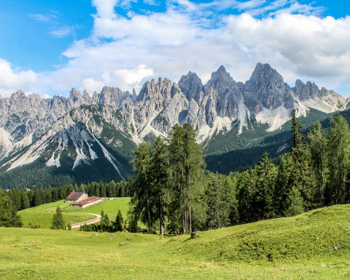
The “forgotten” Dolomites lie to the east, far from the crowds of Tre Cime di Lavaredo and Val Gardena. Belluno is the main gateway, two hours north of Venice by train or a drive up the A27. From here, the upper Piave valley leads into the quieter Friulian mountains. The land rises gently, opening into pasture, then stone lifting into spires above the meadows.
Traditional local councils, the Regole di Comunità, still manage the land and forests together here, supporting artisans and alpine farmers in scattered hamlets shaped by shared work and resilience. Pastìn (a minced, seasoned mix of pork and beef), malga cheeses, and polenta—once staples for long days in the mountains—are still shared over grappa at the end of the day. Beyond the hamlets, paths lead towards Monte Pelmo or drift into the beech woods of Cansiglio, where deer call at dusk. It’s a wonderful place to experience mountain culture, and these are some of my favorite spots.
Alpine lakes and pools
Lago di Calaita lies beneath the Pale di San Martino peaks. The Val del Mis is west of Belluno, where the narrow SP2 road follows the shore of Lago del Mis. The lake is worth half a day on its own—paddle north by canoe or kayak towards the Cascata della Soffia waterfall, or explore the side gorge of Falcina, where you can swim in still, deep pools of crystal-clear water under the Passerella del Peron suspension bridge, just off the SR203 past Ponte Mas. Alternatively, from the car park at the northern end of the lake, it’s a 10-minute walk to the Cadini del Brenton—a series of turquoise pools carved into white rock, cascading from one basin to the next, some more than four meters deep. A wooden bridge trail runs between them, but swimming here is not allowed.
From the Val del Mis, head northwest towards San Martino di Castrozza, then south through Fiera di Primiero, following signs for the Val Vanoi on the SP79, then climb the road to the stunning Lago di Calaita, at an altitude of 1,621 meters beneath the ramparts of the Pale di San Martino. At dawn, the rock above is grey; by sunset, the whole massif turns gold. Open meadows line the shore, and Rifugio Miralago serves canederli (bread dumplings) and polenta with tosèla di primiero, the local cheese. In winter, the lake freezes, and the meadows are used for snowshoeing. A two-hour uphill walk leads to the darker Lago Pisorno, said to be haunted.
Mountain viewpoints
Head for Agordino—the group of valleys along the Cordevole river, south of Cortina d’Ampezzo—for the highest viewpoints. You’ll experience the same massive Dolomite walls but without the crowds. Park near Rifugio Staulanza and take CAI trail 472. In a couple of hours, climbing gently through sparse larch and open grass, you’ll reach the slopes of Monte Penna and look straight at Monte Pelmo’s immense northwest wall—sheer pale rock rising from the valley floor. You’re standing on gentle grass; across the valley, the mountain is vertical stone. The central basin—the Trono di Dio (Throne of God)—is fully visible. To the west is the jagged profile of Monte Civetta.
For a closer look at Civetta, take the old mule track from the hamlet of Piaia, through woods dotted with tabià, the traditional wooden barns used for storing hay at altitude. After a two-hour climb, the trail opens onto the broad pasture of Sasso Bianco, looking directly at Civetta’s sheer face. Note that the road to Piaia is very narrow; parking at the end is limited.
To the southeast, the Alpago basin opens out. From the small Malga Pian Grant farm, the Costa Schienon ridge leads to the rocky peak of Cima delle Vacche at 2,058 meters. It makes for a fine full day’s hike, with the view widening at every step—Lago di Santa Croce shimmers below, and the Dolomites tower beyond.
Farther north, thThe Campanile di Val Montanaia rises about 300 meters from the floor of its glacial valley. The walk from Rifugio Pordenone takes around three hours over scree and is best for experienced hikers. The Perugini bivouac below the spire has overnight space—when climbers reach the summit during the day, they ring a small bell that echoes across the valley below.
Restaurants
Outdoor dining at Agriturismo Bon Tajer near Lentia. Photograph: Alberto Bogo
The isolation that once made these valleys hard to reach has also kept their food traditions alive. Near Lentia in the Valbelluna, Agriturismo Bon Tajer has hundreds of hand-painted wooden plates and chopping boards hanging from the ceilings and walls. Four generations of farmers have run the kitchen, where dishes use local herbs and valley produce—egg custards are cooked in their own shells, and starters come on beds of moss with foraged flowers. Finish with the farm’s own idromele, a fermented honey drink. The mountains glow purple at sunset from the terrace. It’s a 30-minute drive up from Belluno.
Higher up, above Feltre, Malga Campon sits on the summit plateau of Monte Avena. It’s a stone-and-wood hut surrounded by cattle, horses, and donkeys grazing freely, with views of the Vette Feltrine peaks, the Lagorai chain, and the Monte Grappa massif. In early spring, the meadows fill with white and purple crocuses. The food is homemade—thick slices of bread with pastìn and malga cheese, best eaten under a tree with the animals nearby. Malga Campon is also a starting point for hikes across the plateau. It’s a 30-minute drive from Feltre.
Rifugios and farm stays
The cozy, remote Bivacco dei Loff. Photograph: Denis Perilli
In the north of the region, above Domegge di Cadore, the road ends at Rifugio Padova. But hike on up through the woods and meadows around the Casera Vedorcia dairy, under the jagged limestone peaks of Spalti di Toro, to Rifugio Tita Barba di Pieve (open June–Sept, but book ahead, €50–80 a night including dinner), a beautiful alpine log cabin. The hike takes about two and a half hours on the CAI 342 and 352 trails, but the rifugio serves tasty meals and has comfortable beds. From the nearby viewpoint on Monte Vedorcia, the view stretches over the Centro Cadore lake to the Antelao and Marmarole peaks.
For something even wilder, Bivacco dei Loff, perched under the cliff of Crodón del Gevero, is a cozy stone bothy with a fireplace, a loft for sleeping, and a table by the window overlooking the Valle del Rujo—on clear days, the view reaches the Venetian lagoon. Below, the Via dell’Acqua follows the stream past ruined mills and washhouses down to Cison di Valmarino. It’s about a 90-minute hike from Passo San Boldo on trail 991. You can’t book, and it’s free to stay, so bring a tent in case it’s full.
In the far eastern edges of the region, the Cansiglio plateau rises into a forested tableland. Agriturismo Filippon is just a 30-minute drive from the A27, hidden in an alpine meadow surrounded by fir and beech trees. Mountain cattle graze the clearing, and wild deer also visit. Meals are made with farm-fresh goods, and there’s a barrel sauna and an open-air bathtub. The old Gran Bosco de Reme di San Marco, where Venice once got timber for boat oars, calls from above, and you could walk for days here, lost in the mountain air.
Wild Guide Northern Italy: Hidden Places and Great Adventures from the Dolomites to Tuscany is published on 1 May by Wild Things (£19.99). To order a copy for £17.99, go to guardianbookshop.com. Delivery charges may apply.
Frequently Asked Questions
Here is a list of FAQs about visiting the forgotten Dolomites written in a natural conversational tone with clear and direct answers
Beginner Questions
1 What exactly are the forgotten Dolomites
They are the lessvisited quieter areas of the Dolomites Think of the same dramatic jagged peaks and alpine meadowsbut without the famous names and the heavy tourist traffic
2 Where are these forgotten areas located
They are scattered throughout the Dolomites but common examples include the Fiemme Valley the Fassa Valley the Alpe di Siusi and the Braies Valley
3 Is the scenery really just as good as the popular spots
Yes absolutely The rock formations views and hiking trails are just as stunning Youll get the same wow factorjust with more peace and quiet
4 Why would I choose the forgotten Dolomites over the famous ones
To avoid crowds find cheaper accommodation and have a more authentic relaxed experience You can actually hear the birds and enjoy a quiet lunch on a mountaintop
5 Is it harder to get around without the main tourist infrastructure
Not really The forgotten areas still have wellmarked trails mountain huts and local buses You just wont have huge parking lots or souvenir shops every five minutes
Advanced Practical Questions
6 Are the trails in the forgotten Dolomites less maintained
No The trails are generally just as wellmaintained as in the popular areas The Italian Alpine Club marks and maintains paths everywhere However some quieter trails might have fewer signposts at junctions so a good map or offline app is useful
7 Can I still do the famous multiday treks in the quiet areas
Yes The Alta Via 1 and 2 actually pass through many quieter sections You can also create your own loop in valleys like the Fiemme or the Pale di San Martino which are far less crowded than the Tre Cime area